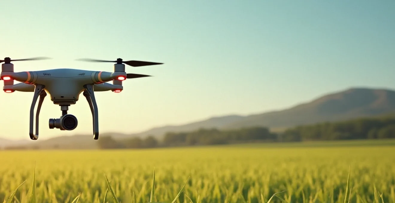
Agricultural drones have revolutionized modern farming practices, offering unprecedented levels of precision, efficiency, and data-driven decision-making. These unmanned aerial vehicles equipped with advanced sensors and imaging technologies are transforming the way farmers monitor crops, manage resources, and optimize yields. As the global population continues to grow and climate change poses new challenges, agricultural drones have become indispensable tools for sustainable and productive farming.
Precision agriculture revolution: drone technology integration
The integration of drone technology in agriculture marks a significant milestone in the evolution of precision farming. By providing high-resolution, real-time data on crop health, soil conditions, and environmental factors, drones enable farmers to make informed decisions with pinpoint accuracy. This level of precision was previously unattainable through traditional farming methods or even satellite imagery.
Agricultural drones equipped with specialized cameras and sensors can cover vast areas of farmland in a fraction of the time it would take to inspect manually. This efficiency allows for more frequent monitoring and timely interventions, crucial for addressing issues such as pest infestations, nutrient deficiencies, or irrigation problems before they escalate into significant crop losses.
Moreover, the data collected by drones can be seamlessly integrated with other smart farming technologies, such as IoT sensors and farm management software, creating a comprehensive ecosystem for precision agriculture. This synergy of technologies empowers farmers to optimize every aspect of their operations, from planting to harvesting.
Advanced sensing capabilities of agricultural drones
The true power of agricultural drones lies in their advanced sensing capabilities. These technological marvels are equipped with a range of sensors that provide farmers with unprecedented insights into their crops and fields. Let’s explore the key sensing technologies that make agricultural drones so valuable:
Multispectral imaging for crop health assessment
Multispectral imaging is a game-changer in crop health assessment. By capturing light reflectance across different wavelengths, including those invisible to the human eye, multispectral sensors can reveal crucial information about plant health and vigor. This technology allows farmers to detect stress in crops before visible symptoms appear, enabling early intervention and potentially saving entire harvests.
The Normalized Difference Vegetation Index (NDVI), derived from multispectral imagery, is particularly useful for assessing crop health and predicting yields. By analyzing the ratio of red and near-infrared light reflected by plants, NDVI provides a quantitative measure of vegetation density and health, helping farmers identify areas that may require additional attention or resources.
Thermal sensors for water stress detection
Water management is critical in agriculture, and thermal sensors on drones are revolutionizing how farmers monitor crop water stress. These sensors detect minute temperature variations in plants, which can indicate water stress long before wilting or other visible signs appear. By identifying areas of the field that are under-watered or over-watered, farmers can optimize irrigation systems, conserve water, and ensure optimal growing conditions for their crops.
Thermal imaging is particularly valuable in regions prone to drought or where water resources are limited. It enables precise, targeted irrigation strategies that maximize water use efficiency while maintaining crop health and productivity.
LiDAR technology for 3D field mapping
Light Detection and Ranging (LiDAR) technology has found a powerful application in agricultural drones. LiDAR sensors emit laser pulses to create highly accurate 3D maps of farmland, providing detailed information about terrain contours, crop height, and canopy density. This data is invaluable for various applications, including:
- Precise land leveling for optimal water distribution
- Planning efficient drainage systems
- Monitoring crop growth and estimating biomass
- Assessing damage from storms or other environmental factors
The high-resolution 3D maps generated by LiDAR-equipped drones enable farmers to make data-driven decisions about field management, crop planning, and resource allocation with unprecedented accuracy.
Hyperspectral analysis for nutrient deficiency identification
Hyperspectral imaging takes multispectral technology to the next level by capturing data across hundreds of narrow spectral bands. This advanced sensing capability allows for the detection of subtle variations in plant chemistry, making it possible to identify specific nutrient deficiencies or early signs of disease with remarkable precision.
By analyzing the unique spectral signatures of crops, hyperspectral sensors can help farmers pinpoint exactly which nutrients are lacking in different areas of their fields. This level of detail enables highly targeted fertilizer applications, reducing waste and environmental impact while optimizing crop nutrition and yield potential.
Data-driven decision making with drone-collected insights
The vast amount of data collected by agricultural drones is transforming farm management into a data-driven science. Advanced analytics and artificial intelligence are being employed to convert raw data into actionable insights, enabling farmers to make informed decisions quickly and efficiently.
AI-powered crop yield prediction models
Artificial Intelligence (AI) algorithms are revolutionizing crop yield prediction by analyzing drone-collected data in conjunction with historical yield information, weather patterns, and other relevant factors. These AI-powered models can forecast yields with remarkable accuracy, allowing farmers to:
- Optimize harvest timing for maximum crop quality and yield
- Plan logistics and storage requirements in advance
- Make informed decisions about crop insurance and financial planning
- Negotiate contracts with buyers based on reliable yield estimates
The predictive power of these models continues to improve as more data is collected and analyzed, making them an invaluable tool for modern farm management.
Machine learning algorithms for pest and disease detection
Machine learning algorithms trained on vast datasets of plant imagery can automatically detect signs of pest infestations or disease outbreaks with high accuracy. By analyzing drone-captured images, these algorithms can identify affected areas of a field, often before symptoms are visible to the human eye.
Early detection of pests and diseases is crucial for effective management and can significantly reduce the need for pesticides. Farmers can target treatments precisely where they are needed, minimizing chemical use and environmental impact while protecting crop yields.
Precision fertilizer application through variable rate technology
Variable Rate Technology (VRT) combines drone-collected data with GPS-guided application systems to apply fertilizers and other inputs at precisely calibrated rates across a field. This technology ensures that each area of the field receives the optimal amount of nutrients based on its specific needs, as determined by drone surveys and soil analysis.
VRT not only improves crop yields and quality but also reduces fertilizer waste and runoff, contributing to more sustainable and environmentally friendly farming practices. The economic benefits of VRT are significant, with farmers reporting substantial savings on fertilizer costs while maintaining or improving yields.
Irrigation optimization using drone-generated NDVI maps
Drone-generated NDVI (Normalized Difference Vegetation Index) maps provide valuable insights into crop health and water stress across entire fields. By integrating this data with smart irrigation systems, farmers can optimize water usage with unprecedented precision.
Irrigation can be adjusted in real-time based on the actual needs of different areas within a field, ensuring that water is applied only where and when it’s needed. This level of precision not only conserves water but also promotes healthier crop growth and can significantly improve yield quality and quantity.
Operational efficiency and cost reduction through drone deployment
The adoption of agricultural drones leads to significant improvements in operational efficiency and cost reduction across various aspects of farming. By automating and streamlining many labor-intensive tasks, drones allow farmers to allocate their resources more effectively and focus on strategic decision-making.
One of the most immediate benefits is the dramatic reduction in time and labor required for field scouting and monitoring. Tasks that once took days or weeks to complete manually can now be accomplished in hours with drone technology. This efficiency translates directly into cost savings and allows for more frequent and comprehensive field assessments.
Moreover, the precision enabled by drone technology in applications such as spraying and fertilizing leads to significant reductions in input costs. By applying chemicals and fertilizers only where they are needed and in the right amounts, farmers can minimize waste and optimize the use of these expensive resources.
Agricultural drones have been shown to reduce chemical usage by up to 30% while maintaining or improving crop yields, resulting in substantial cost savings and environmental benefits.
The operational efficiencies gained through drone technology extend beyond direct farming activities. For example, drones can quickly assess storm damage or flooding, enabling faster and more accurate insurance claims. They can also be used for inventory management of stored crops, reducing the time and labor required for these essential tasks.
Environmental impact and sustainability enhancement with agricultural drones
As the agricultural sector faces increasing pressure to reduce its environmental footprint, drones are emerging as powerful tools for enhancing sustainability. The precision and efficiency offered by drone technology contribute to more sustainable farming practices in several key ways:
Reduced chemical use : By enabling targeted application of pesticides and herbicides, drones help minimize the overall use of these chemicals. This not only reduces costs but also lessens the environmental impact on soil health, water quality, and biodiversity.
Water conservation : Precision irrigation guided by drone-collected data significantly reduces water waste. In regions facing water scarcity, this technology can be crucial for sustainable water management in agriculture.
Soil conservation : By providing detailed information about soil health and erosion risks, drones help farmers implement conservation practices more effectively. This can include targeted cover cropping, reduced tillage, and other soil-preserving techniques.
Carbon footprint reduction : The efficiency gains from drone use often translate into reduced fuel consumption for farm machinery. Additionally, by optimizing inputs and improving crop health, drones can contribute to increased carbon sequestration in agricultural soils.
Studies have shown that precision agriculture techniques enabled by drone technology can reduce greenhouse gas emissions from farming operations by up to 40% in some cases.
Furthermore, the data collected by drones can be invaluable for monitoring and verifying sustainable farming practices. This can be particularly important for farmers participating in carbon credit programs or seeking certification for sustainable or organic production methods.
Regulatory framework and compliance for agricultural drone operations
As the use of drones in agriculture continues to expand, navigating the regulatory landscape becomes increasingly important for farmers and drone operators. Understanding and complying with relevant regulations is crucial for legal and safe drone operations in agricultural settings.
FAA part 107 certification for commercial drone pilots in agriculture
In the United States, the Federal Aviation Administration (FAA) regulates the use of drones for commercial purposes, including agricultural applications. The primary regulation governing commercial drone operations is Part 107, which requires drone pilots to obtain a Remote Pilot Certificate.
To obtain this certification, pilots must:
- Be at least 16 years old
- Pass an aeronautical knowledge test
- Undergo a TSA security background check
The Part 107 certification ensures that drone pilots understand airspace regulations, weather patterns, emergency procedures, and other critical aspects of safe drone operation. For agricultural applications, additional knowledge of pesticide regulations and application techniques may be required.
International drone regulations: EU’s U-Space and beyond
Outside the United States, drone regulations vary widely, but many countries are developing comprehensive frameworks to integrate drones into their airspace safely. In the European Union, the U-Space initiative is setting the stage for harmonized drone regulations across member states.
Key aspects of international drone regulations often include:
- Pilot certification requirements
- Drone registration and identification systems
- Operational limitations (e.g., altitude restrictions, no-fly zones)
- Insurance requirements
Farmers and agricultural drone operators must stay informed about the specific regulations in their region and any changes that may affect their operations. Many countries also have additional regulations specific to agricultural applications, particularly concerning the use of drones for pesticide spraying.
Data privacy and security considerations in drone-based farming
As drones collect vast amounts of data about agricultural lands, crops, and farming practices, data privacy and security have become significant concerns. Farmers must be aware of the potential risks and take steps to protect sensitive information.
Key considerations include:
- Securing data transmission and storage to prevent unauthorized access
- Complying with data protection regulations (e.g., GDPR in the EU)
- Establishing clear policies on data ownership and usage rights
- Implementing best practices for data anonymization when sharing or analyzing farm data
Agricultural drone operators should work closely with technology providers and legal experts to ensure that their data management practices comply with relevant regulations and protect the privacy and security of farm data.
As agricultural drones continue to evolve and become more sophisticated, they will undoubtedly play an increasingly central role in modern farming practices. From enhancing precision agriculture to promoting sustainability and operational efficiency, drones are helping farmers meet the challenges of feeding a growing global population while minimizing environmental impact. By staying informed about technological advancements, regulatory requirements, and best practices in drone-based farming, agricultural professionals can harness the full potential of this transformative technology.